Bangladesh Shorebird Tracking Project
Key species
Migratory shorebirds
Location
Coastal Bangladesh
Status
Active
Duration
3 years
Target community
Science | Policy
About the project
Bangladesh supports internationally important wintering populations of migratory shorebirds, yet until recently little was known about how these birds move within the country or connect to the wider flyway. Conservation planning relied largely on count data, without understanding home range, site fidelity, or the use of tidal flats and high-tide roosts.
The Bangladesh Shorebird Tracking Project addresses this gap by deploying GPS-GSM devices and colour-flags to study both local movements and long-distance migration. The findings can inform site management, protected area planning and Bangladesh’s contribution to flyway-scale conservation.
By revealing how shorebirds use dynamic coastal landscapes across tidal cycles and seasons, the project is helping shift conservation from static site-based protection toward connectivity-based and movement-informed management.
The problem
– limited understanding of local site use, home range and connectivity between coastal wetlands
– lack of knowledge on high-tide roosting areas and foraging site dynamics
– poor understanding of long-distance migration routes, stopover sites and flyway linkages
The cause
– absence of fine-scale tracking studies to understand local home range, site fidelity and tidal habitat use
– limited deployment of satellite tags and colour-flagging to determine migration routes and flyway connectivity
– conservation planning historically based on count data without movement ecology evidence
The solution
– deploy GSM-GPS tags to quantify local movement, home range and site use
– implement colour-flagging and international re-sighting collaboration to strengthen flyway connectivity research
– integrate tracking data into coastal site management, protected area planning and national and regional monitoring strategies
Project Goal
To understand both local and long-distance movement ecology of shorebirds wintering in Bangladesh in order to inform site-based, landscape-level and flyway-scale conservation planning.
Project Objectives
– deploy tracking devices on priority shorebird species
– understand local movement patterns, home range and connectivity between coastal sites
– identify unknown sites, high-tide roosts, foraging grounds and critical microhabitats
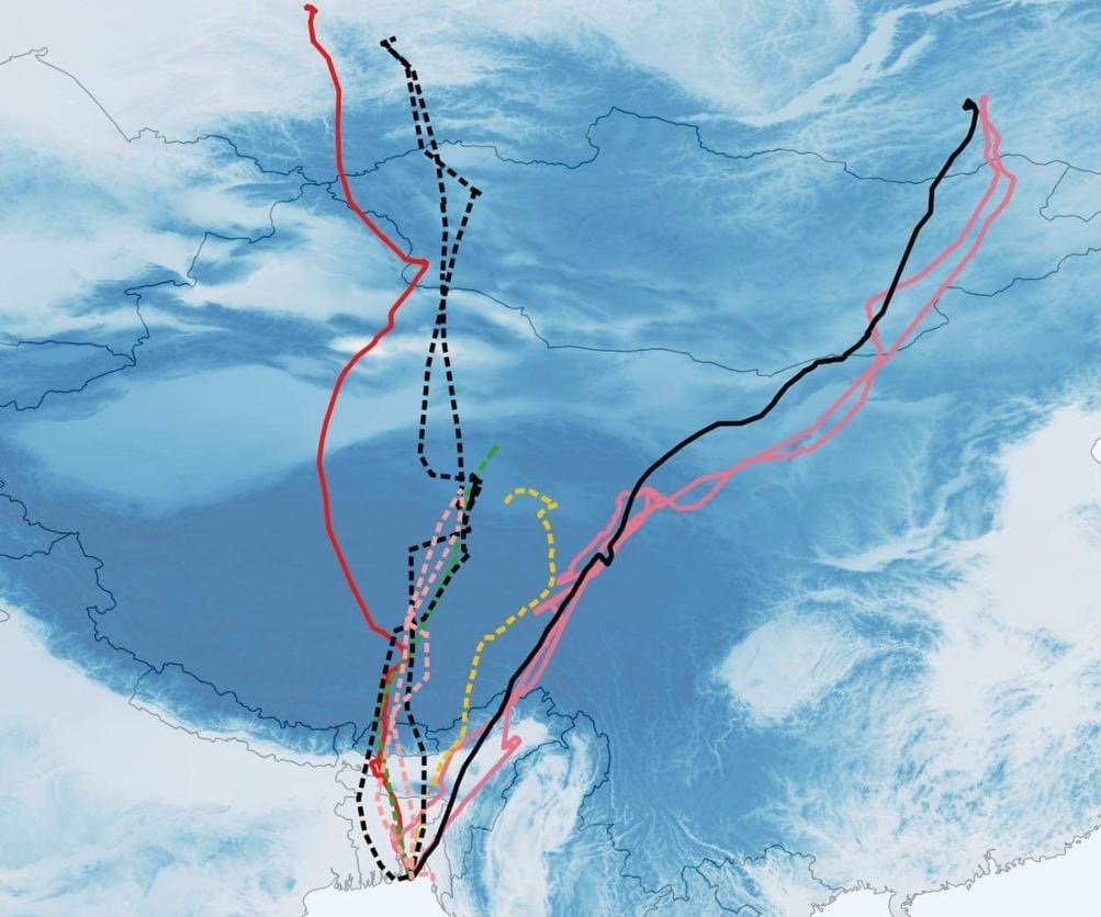
– monitor long-distance migration routes, stop-over sites and international connectivity
– integrate movement data into conservation planning and site prioritisation

Activities
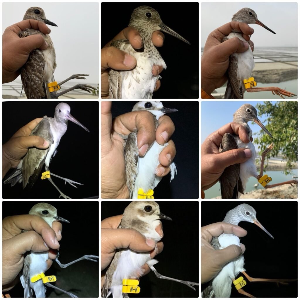
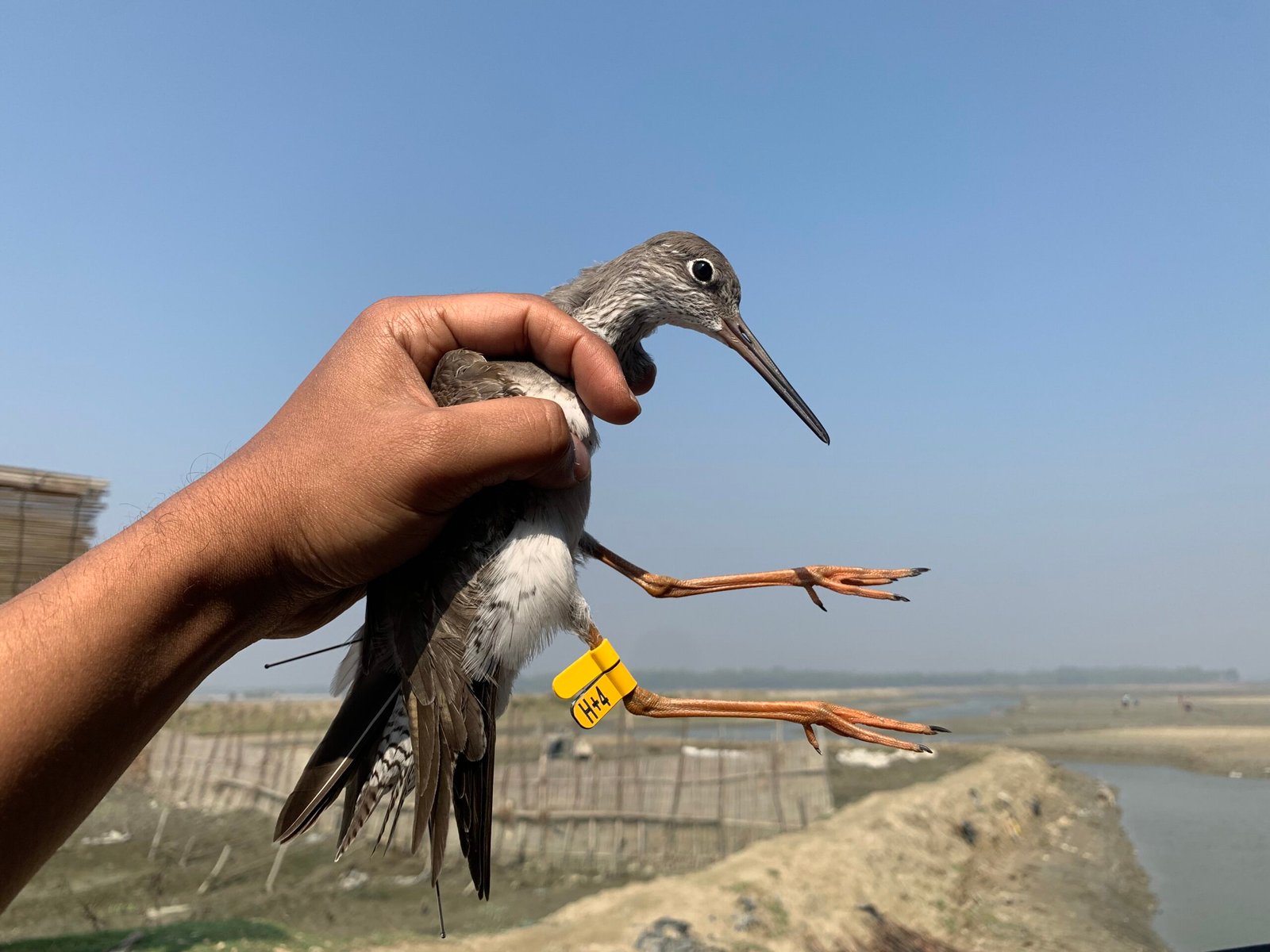
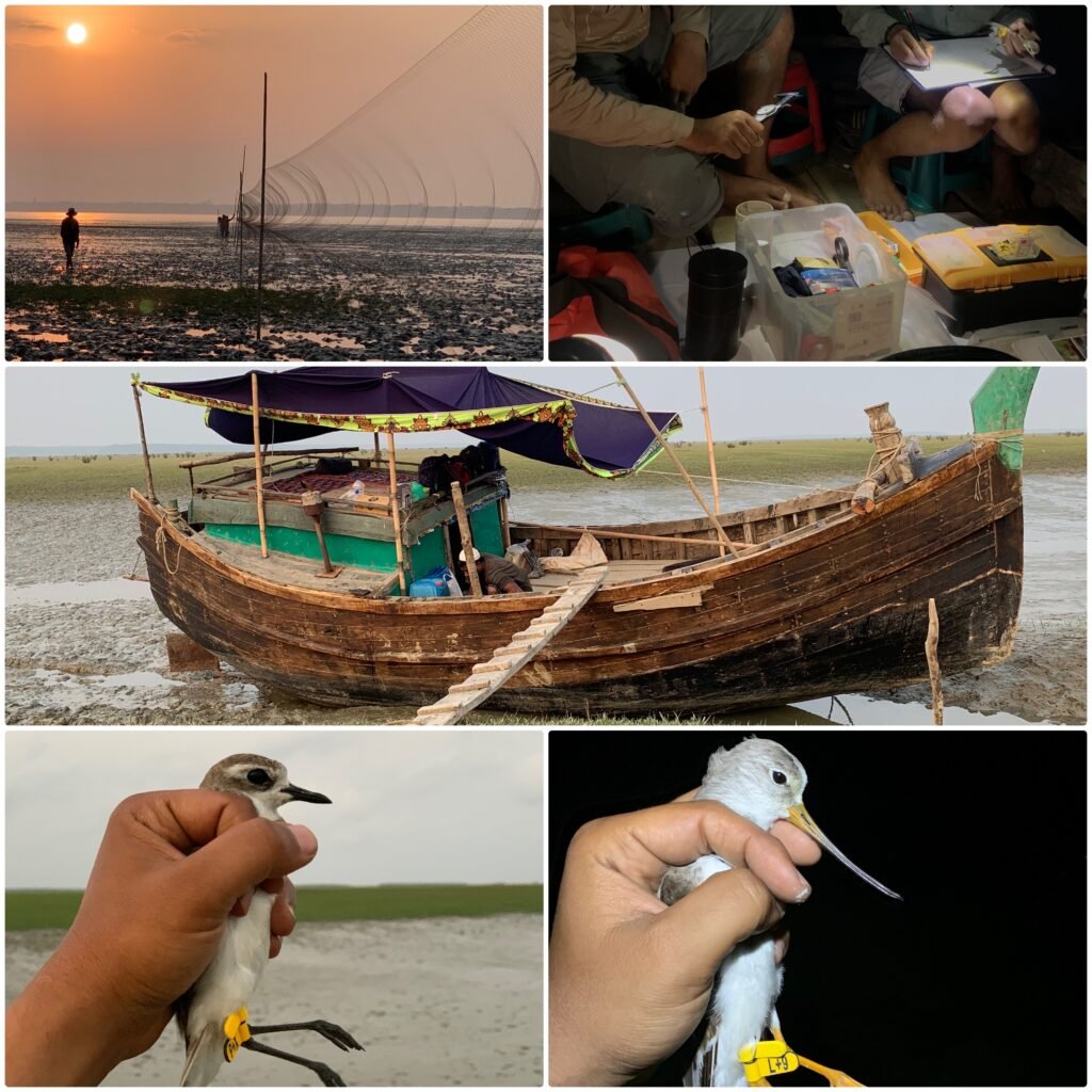
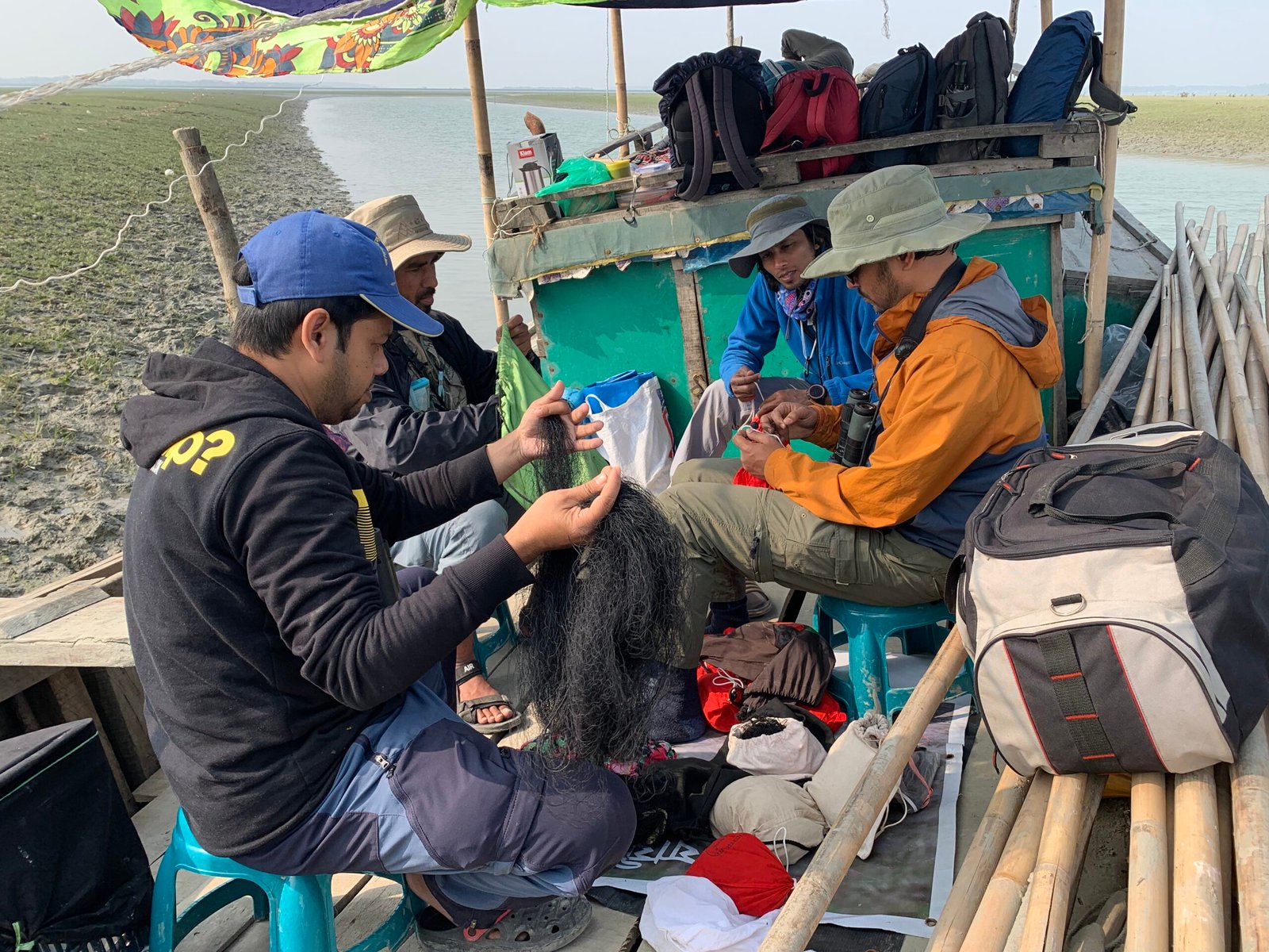
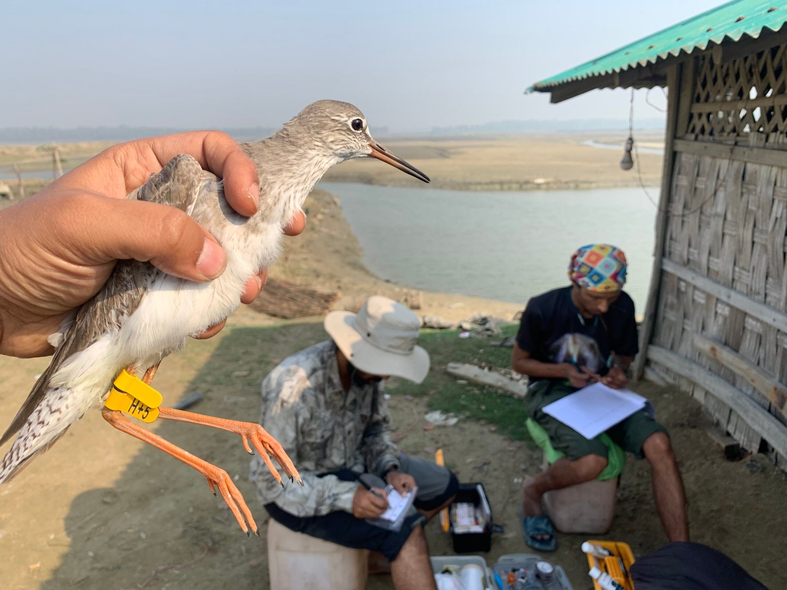
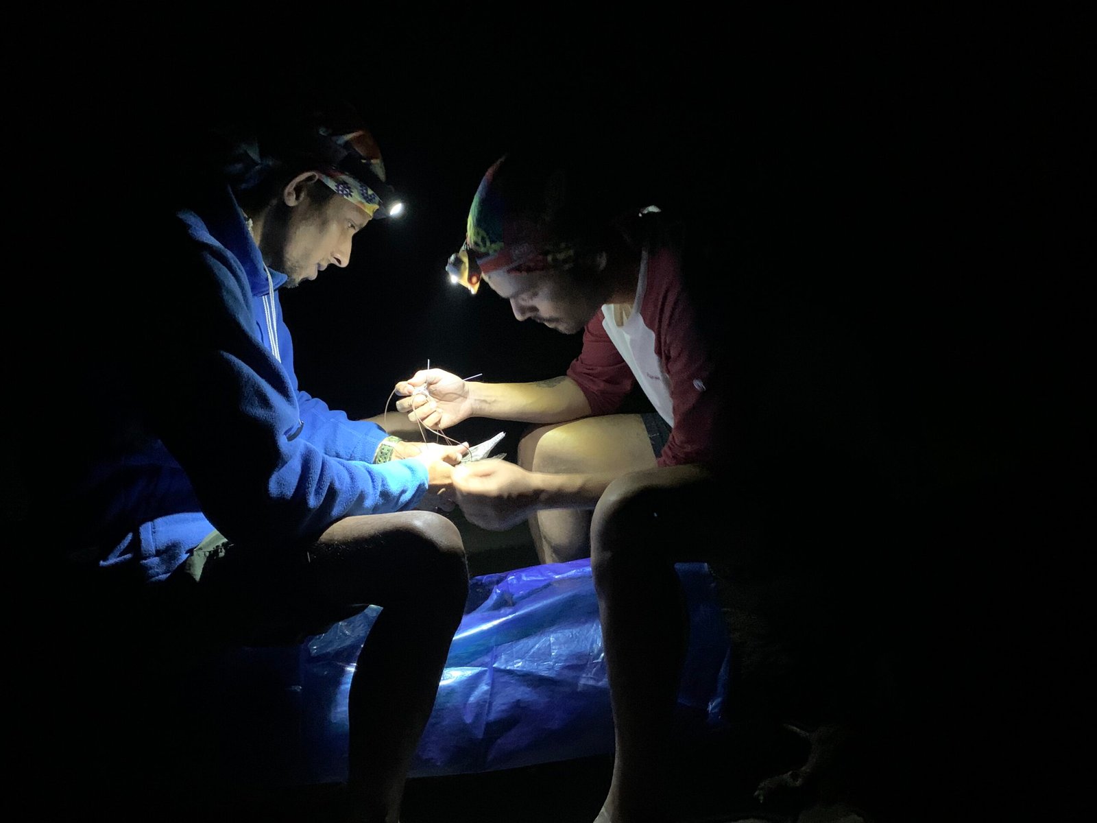
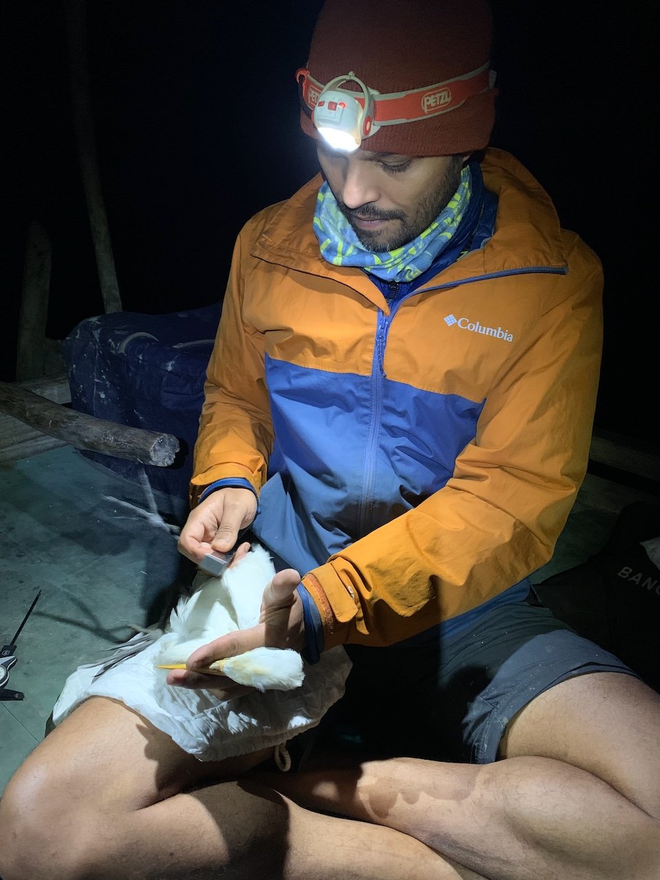
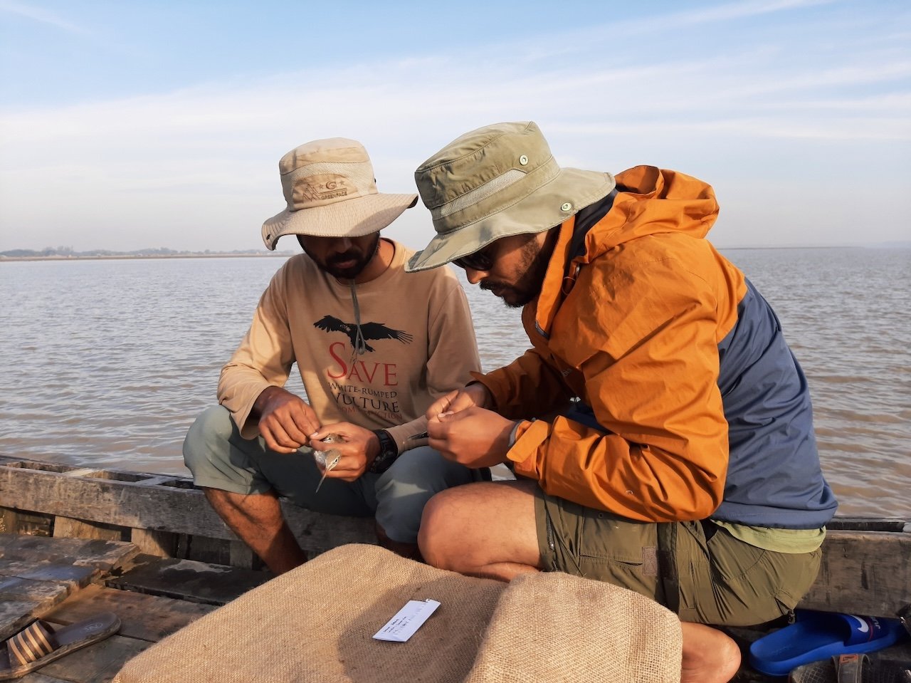
Field teams captured selected shorebird species and deployed GPS-GSM tracking devices and leg-flags to monitor both fine-scale local movement and long-distance migration. Colour flags were fitted to individuals to support resighting and connectivity studies.
High-resolution tracking data were analysed to determine:
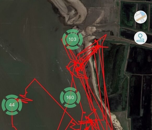
home range size and local movement
connectivity between adjacent sites
high-tide roost locations
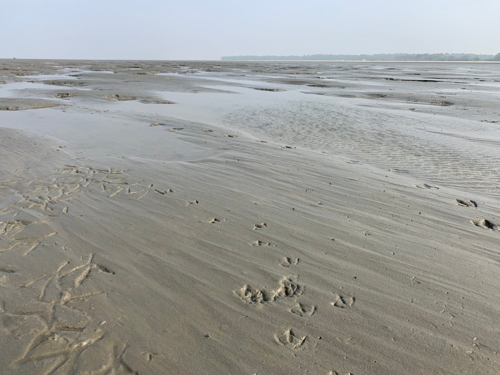
low-tide foraging areas
seasonal shifts in habitat use
These data were combined with field observations and habitat mapping to better understand how birds use the dynamic coastal landscape of Bangladesh.

Outcomes
The project (part of a PhD thesis) generated the first high-resolution movement data for wintering shorebirds in Bangladesh. Preliminary analyses of tagged Common Redshank, Black-tailed Godwit and Eurasian Whimbrel demonstrated that most individuals remained within their primary wintering sites, repeatedly using the same tidal flats throughout the season. This finding fundamentally changed previous assumptions that shorebirds move widely across the Bay of Bengal during winter.
Home-range analyses showed clear species-level differences in spatial use, with Common Redshank and Whimbrel exhibiting relatively small core areas, while Black-tailed Godwit ranged more widely but still returned to consistent foraging grounds. These results provide strong evidence that conservation efforts can be strategically concentrated at key wintering sites.
Tracking data also identified high-tide roosts, foraging areas and fine-scale habitat use across tidal cycles, enabling more precise site management recommendations. The findings support the comparability of mid-winter waterbird censuses (December–February) and reduce concerns about double counting, strengthening national monitoring reliability.
Beyond Bangladesh, satellite-tagged individuals revealed previously undocumented inland migration routes to North Asia and confirmed strong site fidelity, with birds returning to the same wintering areas. These results highlight the importance of inland staging sites outside the traditionally emphasised coastal flyway zones and broaden conservation priorities beyond the Yellow Sea region.
The project also strengthened flyway connectivity research through the deployment of leg-flags, contributing to international re-sighting networks and collaborative migration studies.
Scientifically, the project has established Bangladesh as a contributor to global movement ecology research, with outputs including peer-reviewed publications, technical reports to the Forest Department, and national and international media coverage. The findings are actively shaping evidence-based coastal biodiversity management and flyway-scale conservation strategies.
Meet the Team
Dr. Sayam U. Chowdhury
Principal Investigator
Mohammod Foysal
Co-Investigator
Nazim Uddin Khan
Co-Investigator
Prof. Andrew Balmford
Advisor [research]
Prof. Rhys Green
Advisor [research]
Image Library
Our Partners and Donors